How to choose a kayak
Outdoor Activities | June 3, 2026
SAIL
February 15, 2024
Share


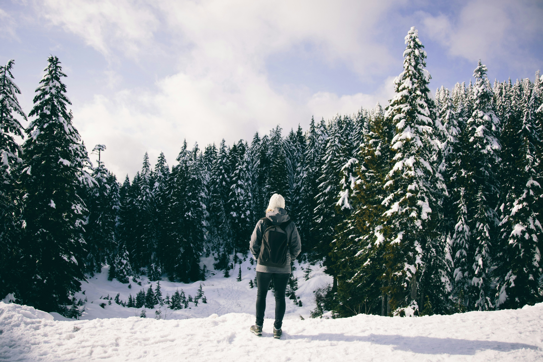
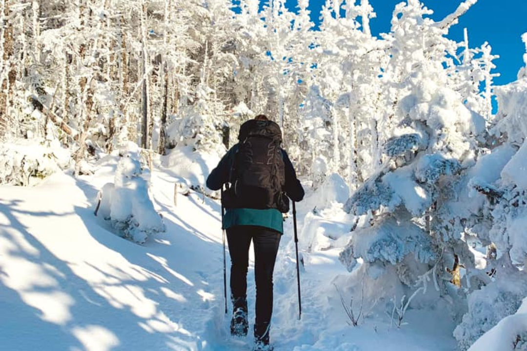
As the temperature drops, most of us just want to lace up our hiking boots and head out into the wilderness for some fresh air and winter adventures. After all, what could be better than snow-covered trees, no crowds and most of all, no bugs? The Passionnés de Rando community lets us know the best winter hiking trail in the province, and why they are worth exploring during the colder months. All that’s left for you to do is to pick your favourite! But before you head out, do read our article on whether to choose ice cleats or snowshoes for your hike.
This article was written in collaboration with Passionnés de Rando
![]()
In this article, you will discover:
@Mélissa Fontaine
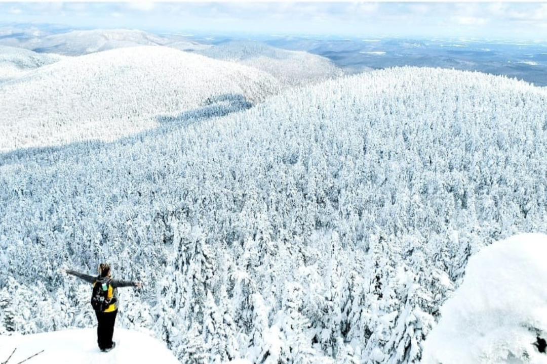
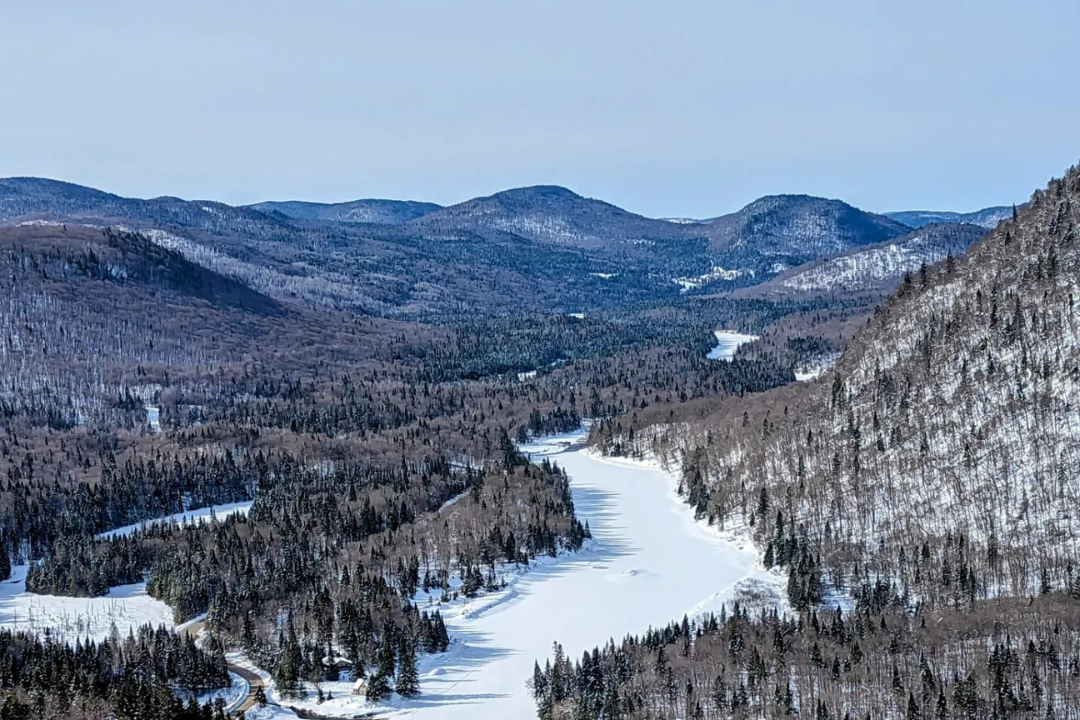
This trail has everything to offer: superb mountain diversity, a good workout and unrivalled panoramic views as you reach the highest peak of the massif. It is the park’s busiest section, however winter does offer some respite from the usual crowds. While it is a fairly steep hike, hikers reaching the top will be rewarded with the sight of the Saint Lawrence plain, the Monteregian hills and a frozen Lake Champlain.
After you’ve completed your hike, stop by Kokkaku Ramen to warm up with a steaming bowl of freshly made ramen. Or read the article for more suggestions of after-hike activities around the Sutton area.
@Anika Landry
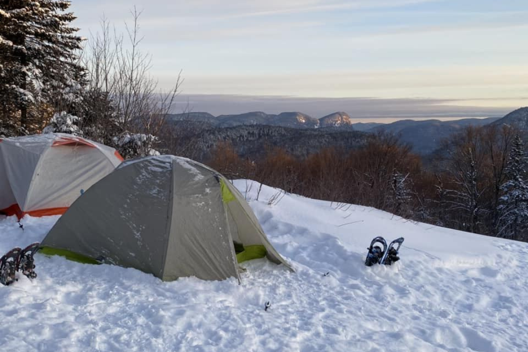
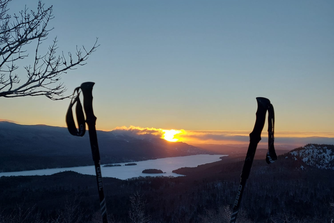
The Vallée Bras du Nord is a popular outdoor destination near Québec City and many city dwellers often head there to escape a weekend of winter camping and snowshoeing. Many will know the Delaney waterfalls, a magnificent point of interest at the end of a fairly flat trail that follows the river. While most will turn around here and head back to the visitor centre, those with a bit of stamina left can continue past the waterfalls, where the trail does start to climb up. Reaching the Delaney yurt is worth it, as the viewpoint there offers superb views over the entire valley.
Once you get back, head for Roquemont Microbrasserie, one of the Passionnés de Rando community’s fav spots. Grab a local beer and a comforting meal and enjoy them while basking in the glow of the warm fire.
@Johanne Dufour
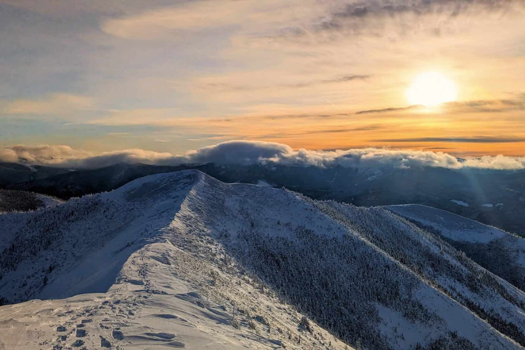
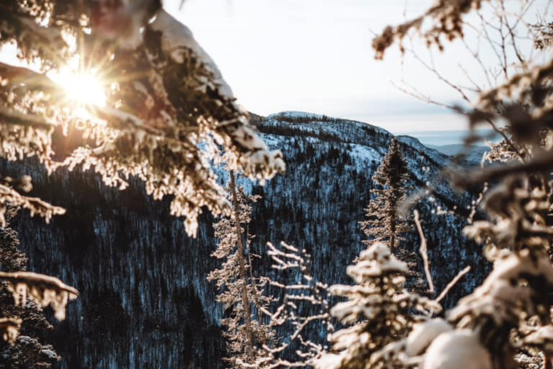
The trail to the top of Mont Vallières-de-Saint-Réal is quite steep from the start, but only once hikers have reached the ridge can they truly unlock the beauty of the surrounding landscape. The ridge links seven peaks, the highest of which is Sterling’s peak standing 940 metres above sea level. The trail is rough, with a lot of rocks to climb and descend, as well as being exposed to the elements. Taking it on during winter requires good hiking boots with plenty of grip and ankle support, as well as a warm windbreaker (shop men’s and women’s winter jackets here), but the sight of Mont Albert and Mont Jacques-Cartier in the distance will quickly make you forget the effort. And so will a nice meal at Bistro-Bar du Gîte du Mont-Albert!
@Alexandra Boily
Hikers who have taken on the Mont Gosford loop can boast of having climbed southern Québec’s highest peak! The trail leading to the barren summit is stunning throughout and follows the Arnold River before crossing a mature sugar bush. Anyone reaching the observation tower will be treated to a panoramic view extending as far as the United States. Do bring a thermos of hot chocolate as there is a pavilion halfway up for hikers to warm up and rest before continuing their journey.
Early risers can hit Café Bistro La Brûlerie to re-energize with fresh coffee and a delicious brunch. Not a morning person? Discover other suggestions of after-hike activities in the area.
@Caroline Mosimann
L’Éperon offers several advantages: its short length makes it the ideal trail for beginners hoping to try on their first winter hike or snowshoe expedition. It is also located at the very entrance of the park, making it easily accessible for those who do not want to dedicate their entire day to exploring the outdoors. But a short hike doesn’t mean a boring one: l’Éperon is actually quite a magnificent trail and follows a bubbling river before opening up and allowing walking enthusiasts to take in a series of breathtaking views of the entire valley.
La Souche in Stoneham is a popular post-hike spot. Stop there for a local brew and to sample the creative menu, which showcases local produce.
@François Therrien
Charlevoix is a well known hiking destination, and for good reason. Its impressive peaks and valleys were shaped by a meteorite impact, creating a rich environment perfect for hiking and exploring. The trail du Dome is one of the many routes that can be taken during the wintertime, and anyone looking for beautiful sights and a good physical challenge can head there for the day. Admire the unique Alpine decor, the views over the St. Lawrence River and the charming nearby town of Baie-Saint-Paul. Speaking of Baie-Saint-Paul, make sure you stop by Le Saint-Pub on the way back for a delicious meal, a local brew or even a tasty coffee to replenish your energy. Hiking in winter can leave you dehydrated (read our article on how to manage your water supply during a winter hike), so there’s no better excuse to treat yourself.
@Marie-Pier Faucher
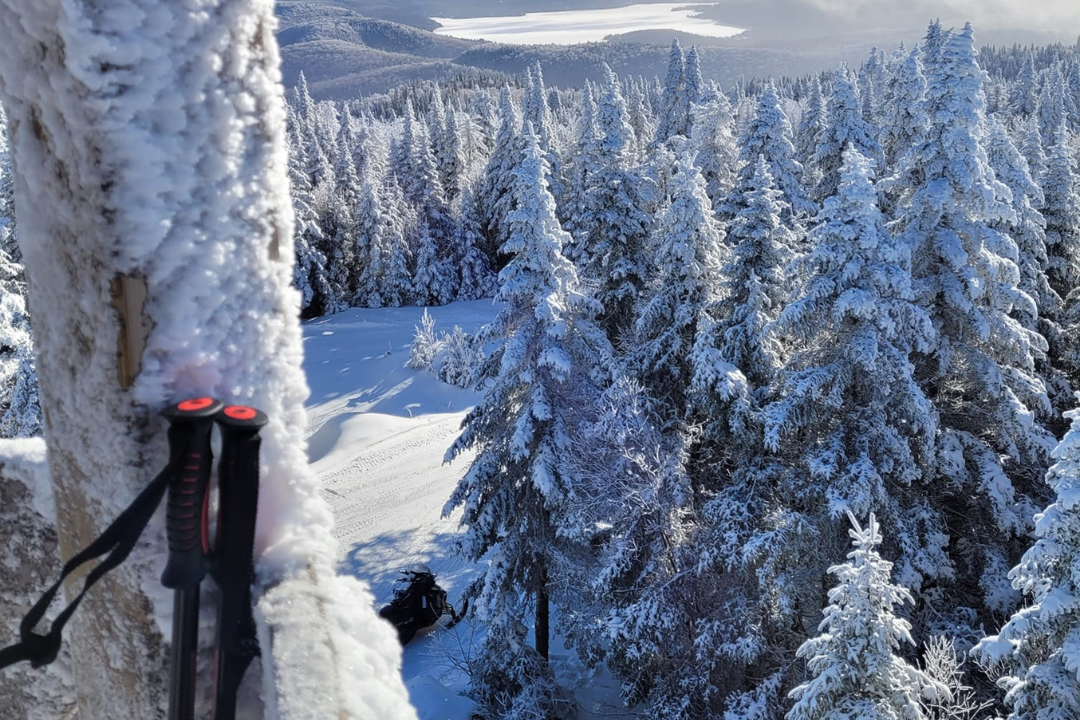
Green Mountain is a popular birding, hiking and snowshoeing area, and boasts a well-maintained trail network. Anyone looking for a quick boost of energy can head there to fill up on fresh air, crisp snow, and beautiful vistas. The moderate hike is a quick one and can be completed by hikers of all levels, with an average time to complete of just over an hour. However, those looking for an extra challenge can combine it with the Indian Nose trail for a total distance of about 10 kilometres, and even more time outside playing in the snow!
Green Mountain is only a short drive away from Mont-Tremblant, a bustling town full of post-hike activity options.
@Marie-Eve Debien
The Liberatore viewpoint has been described as a national treasure, and history buffs will enjoy exploring the site of the 1943 crash of an RCAF Liberator aircraft. The memorial features several plaques, each with details of what is still to this day the worst Canadian military aviation accident. Not keen on Second World War aviation history? The climb up the highest peak in the region still has plenty to offer, including 360-degree views of the Lanaudière and Laurentian mountains. Do make sure you climb to the top of the large observation tower to get the best view. And afterwards? Brouemalt is a conveniently short car ride away from the trail access point!
@Karine Ross
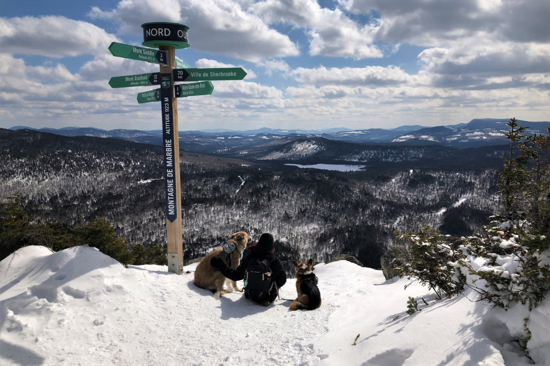
Marble Mountain is quite impressive and features a dizzyingly high and nearly vertical 400-metre-high rocky cliff. Located a few metres from the border between Canada and the United States, Route A promises great views, with a moderate effort, perfect for those short on time but still wishing to make the most of the winter scenery. The trail reveals stunning views over nearby mountains, including Mont Gosford and many mountains located in neighbouring Maine. If this is your hike of choice, do bring your passport with you in case you meander into the American side of the line. But if you do manage to remain in Canada and need an energy boost, stop by Ditchfield Microtorréfacteur for a cup of Joe and a tasty snack.
@Linda Lavoie
The winter hike to beat all winter hikes… The Vallée des Fantômes (which translates to Valley of the Ghosts) is at the top of every winter hiker’s list. The area is famous for its majestic snow-covered trees (or ghosts), which stand guard throughout the cold season. While short, the trail is a jaw-dropping one. With views over the Piedmont hills, the Mont Valin massif as well as the Saguenay lowlands, there are beautiful landscapes as far as the eye can see. The hike is extremely popular and you’ll need to book early in order to save your seat on the shuttle that takes guests from the Discover and Visitor Centre to the start of the trail. After such a legendary trip, treat yourself to an award-winning drink! Visit Distillerie du Fjord to sample the famous km12 gin.
Thanks to Passionnés de Rando for the top recommendations, you can now head out and explore Québec’s many winter hiking trails and enjoy the crisp air, the snowy landscapes and the many frozen lakes the province has to offer. So strap your snowshoes to your backpack, dress up warm, slip your ice cleats into your bag, and make the most of the winter months!
Voir cette publication sur Instagram
Share